Covering 290 miles in North Georgia and Southeast Tennessee and climbing a leg-busting 33,000 feet, the Cohutta Cat is a figure-8 loop traversing the gravel, pavement, forest service roads, and single track of the beautiful and challenging Southern Appalachian Mountains and is the genius creation of Georgia-native, Daniel Jesse. The route was created as a slightly shorter alternative to the Trans-North Georgia Adventure (TNGA) and therefore avoids much of the TNGA route, purposefully. Find more information and stunning pictures at Bikepacking.com - Cohutta Cat.
So, Fall arrived and it was time for another Bad Idea Club adventure. Yes, we already had one in the spring when we tackled the Monumental Loop in New Mexico, but there's nothing wrong with a bi-annual meeting. Unfortunately, Cody was the only one free to tackle the Cohutta Cat. But I had recently spoken to PJ Terry about his TNGA co-win and reached out to him and was happy to hear that he'd love to join us; he has plans to race the grand depart in Spring '23 and saw this as an excellent opportunity to scout the course. In addition to that, I had recently met and then raced with Matt Schweiker at the 5 points 50 and mentioned our adventure to him to which he happily obliged. Matt has completed the Colorado Trail Race and, most recently, earlier this year, the Silk Road Mountain Race. So, quite a solid crew was formed. And Cody was scared.
We didn't do a lot of planning as it didn't really seem necessary. Cody and I had decided we would "credit card camp" or just stay at a hotel both nights, and knock the course out in three days. This meant we could travel lighter, leaving the sleep setups at home.
The route is designed to start/end at Mulberry Gap - Mountain Bike Getaway but we altered our start point for logistical reasons. Starting at mile 38, near Cisco, GA, would give us 100 miles to Blue Ridge on day 1, a 112 mile loop out of and back to Blue Ridge on day 2, and then something like 75 miles from Blue Ridge back to our start point on day 3. This allowed us to use the same hotel both nights, as the figure-8 actually crosses in Blue Ridge. This also allowed us to leave stuff in the room (i.e. seat bag) for day two.
So, after a full week of working 12 hour shifts and little time to prepare, Friday rolled around and it was go time. Cody and I met at Handup HQ at 6:00am and headed south to meet PJ and Matt at 7:15 on old Highway 2 at the West Cowpen Road intersection, where we left our vehicles, right on route.
Every big adventure seems to start with some weird shit happening and there was no shortage this time. I climbed out of my car to find that the interstate turbulence had pulled one of my two 1L bottles right out of my feed bag on the handlebars. Awesome. One bottle for 300 miles. Luckily, Cody offered up his third bottle since he's a shit-show and would likely get behind on hydration anyways. I think I was supposed to buy a large bottled water at a gas station and give his back, but never did.
We did final preparations, I freaked out a little about bringing too much crap, went through my dry bag of clothes and discarded things to my back seat, like leg warmers and base layers and extra shorts, yada yada yada. The usual. Cody turned his garmin on. Nothing. Tried again. Nothing. It wouldn't turn on at all. Great way to get started. PJ and Matt were probably just watching us and wondering WTF they'd gotten themselves in to. We finally gathered ourselves and rolled out straight into a swift descent with a face full of crisp 34 degree air. Great idea discarding that base layer and leg warmers....Oh, and the garmin came on as soon as we started moving.


It was an awesome morning on familiar gravel roads. We had about 100 miles and 12-13k feet of climbing ahead of us. It was rather uneventful and we rolled briskly and steadily with minimal stops all morning. For those familiar, we went across Jack's River, up Ladd Springs Rd to Sina Branch Rd, past Ocoee Lake to 302 and on to Peavine Sneeds Creek Road to eventually turn left onto Big Frog Road and head towards Thunder Rock and the Ocoee River. We chose to cut out the Sylco Trail portion as it can be a bushwhacking time-suck with lots of downed trees.
Oh, and, an hour or two in, I noticed a small puddle in the bottom of my feed bag. The only bottle I arrived with had a small hole in the bottom and was slowly leaking, so I had to ride with the bottle upside down. Par for the shit-show course.
Cody saying I'm #1
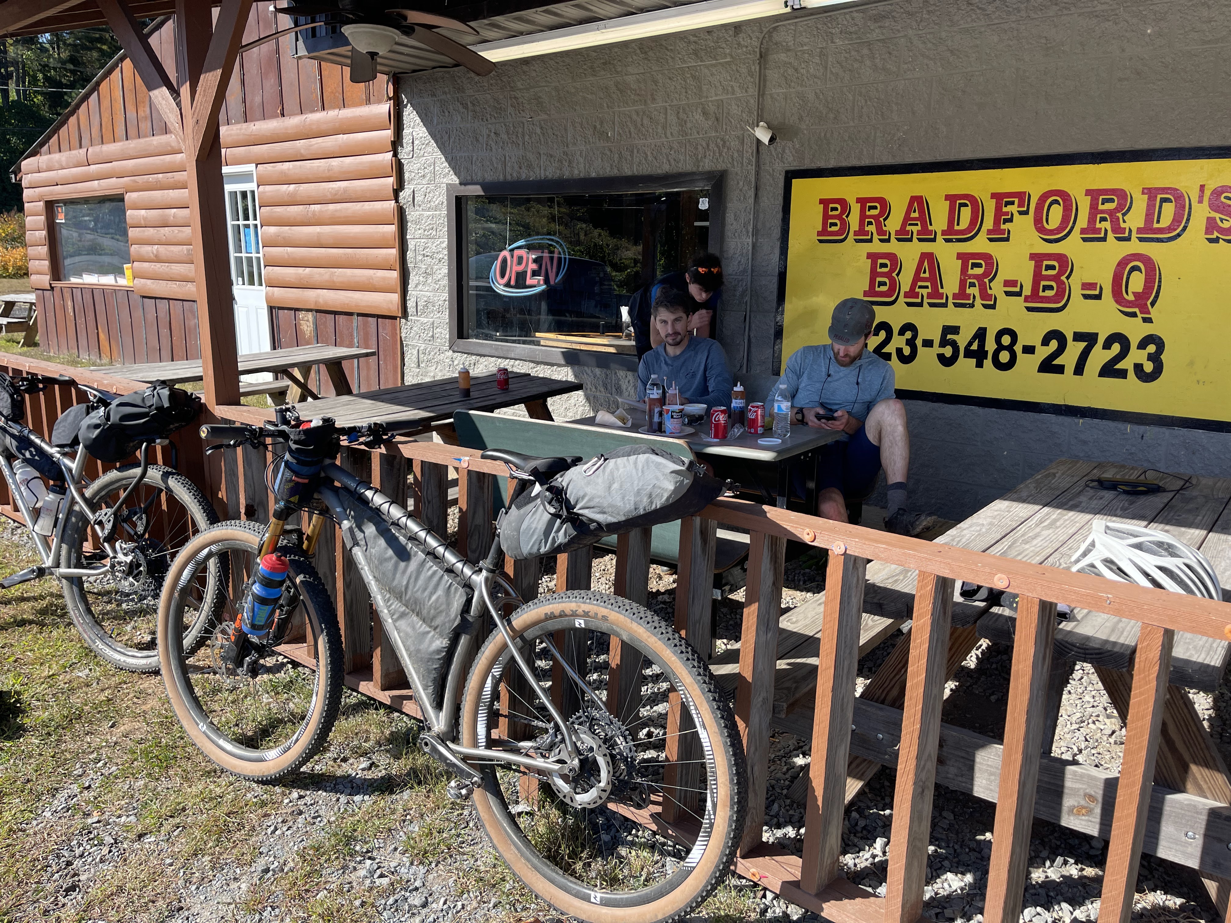
Maybe 50 miles in, we hit Thunder Rock CG to grab some potable water (which was a brownish color, but tasted fine) and then rolled on through the rhododendron tunnels along the Ocoee River, making our way to Old Copper Road, up Boyd Gap, through the flat and flowy Brush Creek Trail, and eventually into Ducktown, TN around 2:15pm for some gas station resupply and Bradford's BBQ. We were about 65 miles in with 35 miles and one monster climb to get to Blue Ridge.
As we neared Ducktown, I had awesome realization: our first 60 miles were pavement-free. That was sweet! Everything we rode was familiar but the next 35 miles were going to be unfamiliar, or so we thought.
Luckily, we narrowly escaped Bradford's BBQ without having to wrestle an energetic local who was suspicious that we had taken his sunglasses he thought he'd left at the table next to us. It was awkward as he sat in his car, toking on a cigarette, seemingly contemplating further accusations of sunglasses theft. And even more uncomfortable as he rummaged through the back of his SUV and just happened to have to move a machete to look for them. I think we all made sure to don our own sunglasses as we rolled out of the parking lot. Sorry for your loss, pal.
After a few miles of pavement, someone noticed that we were in familiar territory which was Tumbling Creek Road; this is the start of the towering climb up to Watson Gap, which can be found in the Cohutta 100 and Death March Loop.
As we started up the lower gradients of the climb, we passed two massive road graders coming the opposite direction. That is usually an ominous sign. Sure enough, the road turned to crap where they had just graded it for miles. Soft churt and loose rocks were aplenty. It could have been worse, I guess.
We hit Daily Gap, which is a trailhead for hikers, and chatted with some nice gentlemen from the Benton McKaye Trail Association who were camping and doing trail work. Thanks to them for their efforts! We proceeded to the top, which was about 1500' above the base, turned left down a ripping gravel descent which was another Highway 2, and did our longest paved section into Blue Ridge, arriving around 7:00pm, hungry and ready for some sleep.


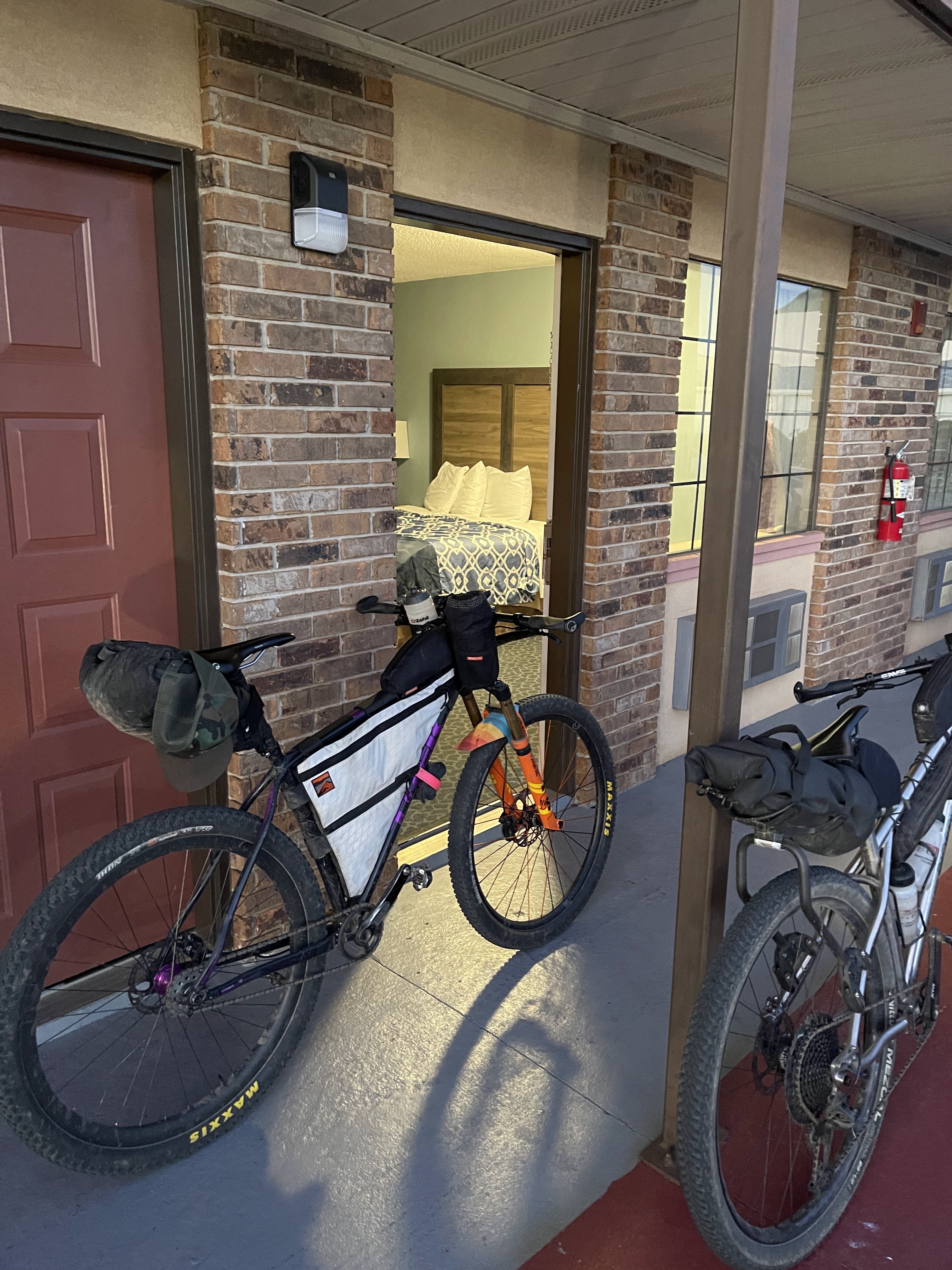
We stayed at America's Best Value hotel (motel?). There's some give and take with cheap hotels. It was dirty, smelled like a hamster cage, and had stains on the walls and tub, buuuuuuut, it was right next to a Waffle King, grocery store, and Dominos Pizza!! I think it was a win. While we waited for our pizza order, we used the grocery store to stock up for a big second day with no food resupply options. We headed back to the room to shower, eat, and hit the hay. Luckily, Matt was the only one who heard scratching at the door for nearly an hour at 3am. Thank you sweet baby Jesus!
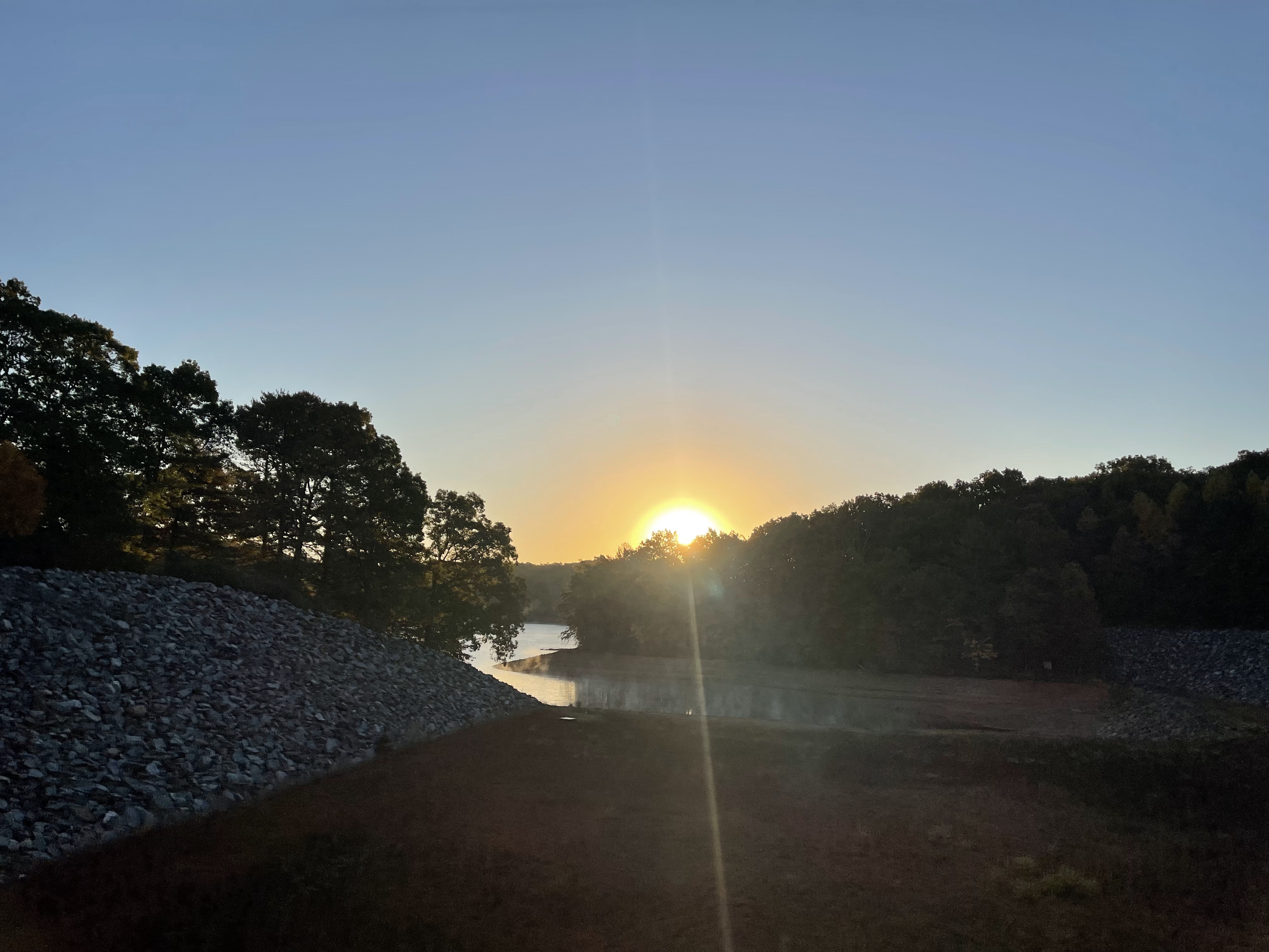
We woke up Saturday, gathered some things, dropped some things in the room, hit the Waffle King for some carbs and coffee, and rolled out for 112 miles and 13-14k feet of climbing. Probably safe to say we all underestimated the difficulty of the day. It was a little tough to get warmed up and get going but, nonetheless, it was a beautiful, crisp, fall morning to roll out along Blueridge Lake.
We made our way through Old Dial Rd which was a scenic, twisty and turny mountain road that took us through Sandy Bottoms Recreation Area along the Toccoa River before we turned left onto a forest service road for about 13 miles of intermittently chunky/rocky gravel.
Another uneventful morning came and went as we explored the Chattahoochee-Oconee National Forest in all it's glory. We made our way through another recreation area where we started to encounter hikers and eventually the 270-foot long suspension bridge spanning the Toccoa River.
We popped out on Rock Creek Road which was a familiar climb, taking us past the Chattahoochee Forest National Fish Hatchery, Rock Creek Lake, Hightower Gap where the Appalachian Trail crosses, and eventually topping out at Mauldin Gap about 1000' later, where we took some time for a brief lunch.
After lunch, we descended Cooper's Gap, which is a bomber descent, passed Camp Merrill, and started our way through the Jake and Bull Mountain trail system. We had some fun, flowy single track but also some really rough and loose forest service roads and some hike-a-bike up the blown out trail known as Bear Hare. With the overall fatigue, these felt like some really slow, tough miles.
After Jake/Bull Mountain, we hit Nimblewill Gap Road and stopped to check out Matt's rear hub, which had started to sound like a Skrillex concert. It sounded like it was about to go, and we weren't able to get any assistance, so he opted to just ride it until it blew up.
All day, our goal was to make it to the Toccoa Riverside Restaurant, at mile 100 for the day, for some real food, before knocking out the remaining 12 miles to the hotel. It closed at 9. We had about 32 miles to go, and it looked like we could probably make it by around 8:00pm, with no lollygagging.
We hit the road, which quickly turned to gravel and began to go up. None of us knew that we had a 1500' ascent up Nimblewill Gap Rd which closely resembled a jeep road with it's abundance of chunky rocks and chunder. Forty-five minutes later, we were at the top, at Nimblewill Gap, and happy to descend the other side, only to find out that it was even rougher and bone-rattling at high speeds. I felt like I was about to lose both of my arms. But, we made it to the bottom alive and hungry and kept moving. You know what I did lose, though? The leaky bottle. Looked down to find an empty feed bag. Cody's loner was the sole remaining bottle.


Night came. Lights were turned on. I almost had a hunger and fatigue melt down. We powered through some more gravel and pavement, finally making it to Aska Road and a packed restaurant around 8:15pm, where we found cars lined down the street and a long wait. We were so lucky to find 4 seats at the bar and sit down right away. Calamari, pimento dip, and burgers, oh my!
Leaving the restaurant was tough. It was cold and we had to go straight up Aska Road and into the Green Mountain single track. We blasted the awesome descent down to Blueridge Lake and circumnavigated a portion on gravel. We finally arrived back at the room just after 10:00pm, I think, 14 hours after we had started. I was so tired, I barely slept that night. Weird, right? Luckily, no door scratches were heard.
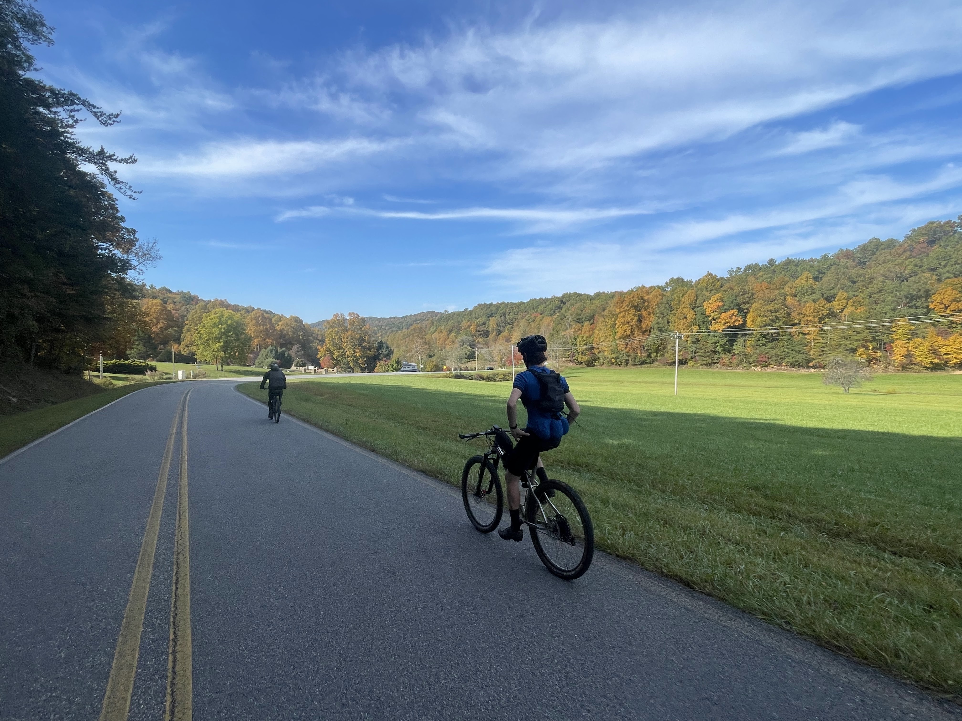
Day 3 was roughhhhh getting up and moving. My legs and body were not happy with me. We had about 75 miles and 10k feet of vertical to get back to our vehicles. We packed up, went to Waffle Kind and the gas station, and then hit the dusty trail. Or pavement, really.
 |
| Cody embraces Gas Station Meditation |
After some paved miles to try to get warmed up and feeling better (fail), we turned into some small steep road led to rental access roads with regular gradients of 20-24%, which means I was pushing the single speed on pavement. No reason to burn the energy muscling up those hills. Straight to the top and straight back down, picking up the scent of burning brakes from the trio ahead of me.
 |
Too bad pics do hills no justice
More scenic paved and gravel roads, more paved hike-a-bike climbs (only for some of us), and we were headed into Wolfpen Gap, which was familiar territory for most of us. I was excited and hopeful that my previous goat-friends were out for us to stop and say hello to.
After goat hangs and some lunch, we got moving, headed towards Mulberry Gap and the pinhotis. I knew the Fort Mountain area was going to be our toughest section yet, and it sure as hell didn't let me down. We passed the Bear Creek entrance, went up Wilderness Rd. and knocked out Pinhoti 2. A brief chat with Andrew Gates of Mulberry, at the bottom of P3, and up we went. I hiked quite a few sections and emerged at the top to find the other three looking like they'd been camping there for 3 days waiting on me. Onward to P4, P5, Tatum Lead, Peeples Lake Road, and the dreaded hike-a-bike connector trail back up to Fort Mountain State Park where some resupply awaited us.
After another short break and $30 in snacks, we bombed down some amazing, rocky, leaf-covered single track and rhodo tunnels only to find a few more climbs and a lot of stinging nettles.
Another long section of flat pavement, where I pedaled my spinny gear off the back, in no man's land, over to our last big gravel climb, which was Mill Creek. It was about 6 or 7 miles and 1200' feet of gain. Once to the top, it was a left on West Cow Pen Rd and bomb downhill to our cars to the finish!! Wrong.
It was a left on some other service road, which led us to a gate and a seldom-used section of single track that was lined with death-briars and hidden boulders and deadfall. A descent down to a creek and a climb back out to West Cow Pen Rd, when we could have simply ridden gravel to get there. Damn you Daniel Jesse!
I should add, on the service road to overgrown hell, after 280 miles with no issues, just as it was getting dark, I slammed an invisible rock and got a rear double-puncture flat. After 3 dyna-plugs, it was holding air and good to go.
Finally at West Cow Pen, we blazed the descents and hammered the short punchy rollers to come to come skidding up to our vehicles just before 8:00pm, 11 hours after starting in Blue Ridge. I was toast and ready to get some food and get home to see my wife and pup.
Thanks Cody, Matt, and PJ for making it an awesome three days exploring on bikes; you are all insanely strong riders and just makes it even better. And thanks to my wife, Melissa, for giving me the time for these adventures. Thanks Owen Cyclery for always taking great care of me and my bikes. And thanks to Daniel Jesse for your time and efforts on this incredibly beautiful and challenging route showcasing some of the best scenery North Georgia has to offer!
Thanks for reading. Until next time.
And a shameless plug...if any of you outdoor enthusiasts, or anyone else, really, have any interests in exploring the east coast's infinite outdoor opportunities, reach out to me at VistaAdventureVans@gmail.com to rent our Ford Transit High Roof and bike rack!
|


Nice write up, Homie!
ReplyDelete