Blue Ridge Parkway - Full Pull, Part 1


"The Blue Ridge Parkway is a National Parkway and All-American road in the United States, noted for its scenic beauty. The parkway, which is America's longest linear park, runs for 469 miles (755 km) through 29 Virginia and North Carolina counties, linking Shenandoah National Park to Great Smoky Mountains National Park. It runs mostly along the spine of the Blue Ridge, a major mountain chain that is part of the Appalachian Mountains. Its southern terminus is at U.S. 441 on the boundary between Great Smoky Mountains National Park and the Cherokee Indian Reservation in North Carolina, from which it travels north to Shenandoah National Park in Virginia." - Wikipedia
Somehow, I have never been on the parkway itself. I have done races and weekend bike trips to the Pisgah/Brevard area, but, nope, never actually been on the parkway. Not in a car, not on a bike, not on foot. But that was about to change.
Late one evening, while lounging and watching TV, I received a text from a friend, Cody Wallis, that simply said "Would you have any interest in riding the Blue Ridge Parkway?". Now, in the covid era, racing, and even general motivation to ride/train, had been at an all time low. Therefore, without any questions, my response was simply "absolutely!". I had no idea of distance, or elevation gain, or logistics, but it didn't matter; I was just happy to have something to look forward to and train for. We decided on October 1st-4th, so this gave us about 1.5 - 2 months to get some training in.
The idea to ride it actually came from another friend, Justin Mace, who is the race director for the 5 points 25/50 mile race on Lookout Mountain in our hometown of Chattanooga, TN, and who has a rather impressive history in mountain bike racing. But Cody was the masochist who decided we should do it in 4 days. For the time being, there was just a 3 man wolf pack, but it didn't take long to rope our SORBA president, Les Warnock, in for the ride. He is currently an enduro-bro, and damn good at it, but has done some XC, gravel, and road biking, as well as a lot of rock climbing; he's just an all around good athlete. However, he has not really done any endurance events like this so he was a bit apprehensive about the whole thing and hit the ground running with his training. He had some self doubts but we all knew he was really strong and wound have no problems rising to the occasion. So there it was, coming to fruition, and the four of us began to put our plan together over the coming weeks.
The days seemed to fly by and before I knew it, we were just two weeks out. Les, Justin, and myself trained decently well, putting in several 10k foot climbing days in the last two weeks, and Les did a mixed surface century (which was actually his first century ever), among many other big training rides. Cody, well, he golfed and drank beer, and "trained for mental toughness" as he told us. We made fun of him but we all knew how well he could rise to any occasion with minimal training. We never had any doubts about his abilities.
Being a point to point route, the logistics are a bit more difficult than if it were a loop. Leaving a car at the beginning was less than ideal, due to the 500 mile drive back to get it before being able to go home. Luckily, there's an old worn out roadie named Nick "Jelly Balls" Nichols who was just the person for the job. Out of the kindness of his heart, he agreed to load us up in his sprinter "Eddie VAN Halen" and drive us to Cherokee, NC to the start. The original plan was to ride with us, doing an out-n-back on day 1, so he would get a ride in, and then drive back home. Unfortunately, life happened, and he only had time to just drive us there, spoon with Justin overnight, and head back home after dropping us off at the start of the parkway.
I packed, traditionally, only a few hours before it was time to leave, which left me ill-prepared a few days later; story of my life. We rolled out of Chattanooga around 5:30pm on 10/30, headed for Cherokee, NC. We grabbed some cheap Italian food in Cleveland, TN. Most of us had a normal meal. Cody ate like he was pregnant with twins.

We rolled out of Cleveland, grabbing a bag full of Taco Bell cheesy been and rice burritos for day 1 of the ride. Cody, Les (and wife Kaleena. Oh, and HUGE SHOUT OUT to Kaleena and Jamie Wallis for running support vehicles for us!!! THANK YOU!!!), and myself stayed at a Hampton Inn in while Justin and Nick spooned in his sprinter van at a quant, romantic camp ground next to a soothing babbling brook.
We awoke at 5:30am to begin our preparations, grabbed some world-class continental breakfast downstairs, and awaited our chariots arrival from the campground. On today's agenda: 135 miles and 17,000 feet of elevation gain. And the weather was set to be prime, with morning temps around 45 and afternoon highs in the low 70's, and nothing but sunnnnnnnnnnnnshine.

Just a short 3 mile drive and we had arrived at the beginning of the parkway.
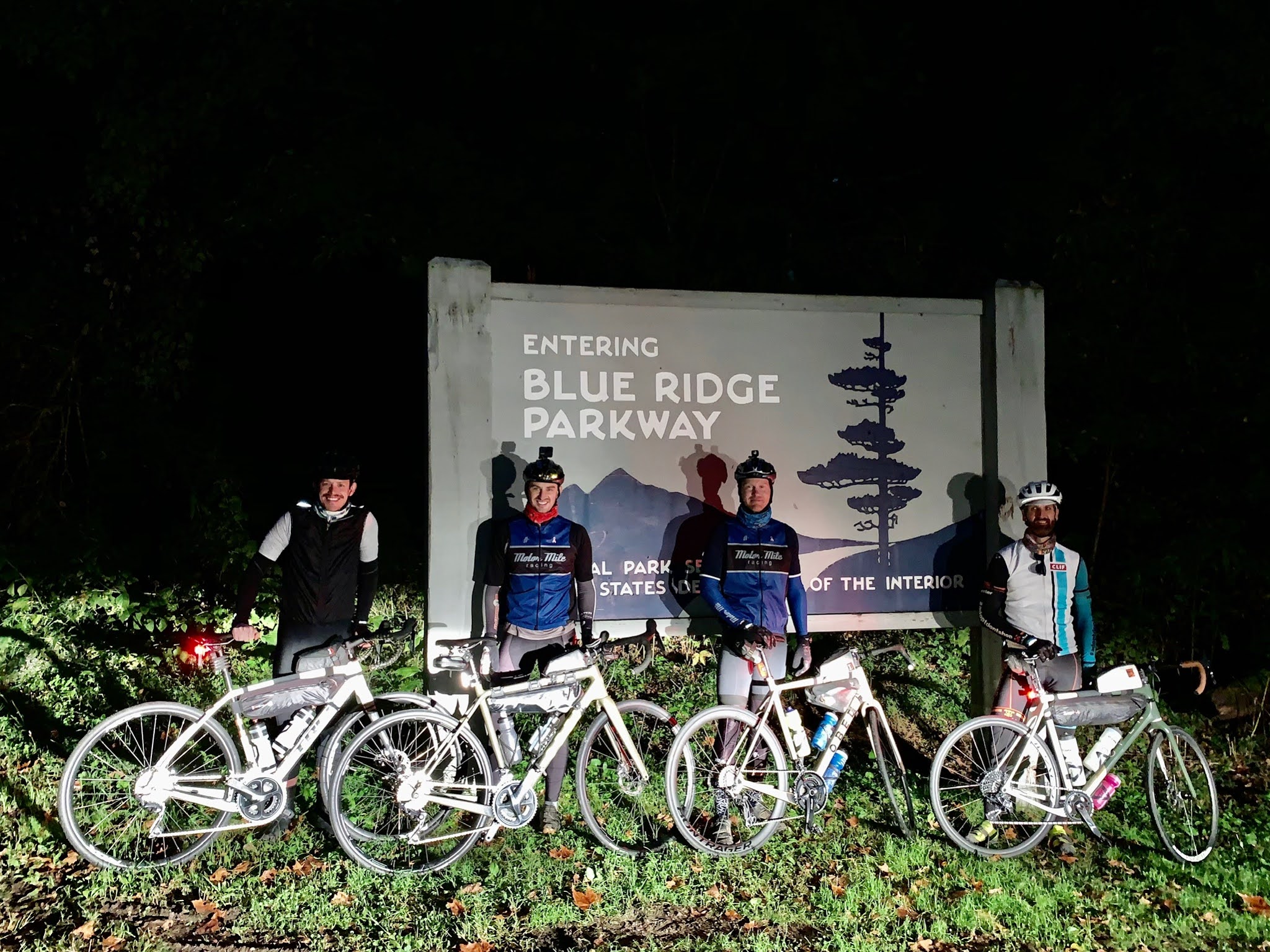

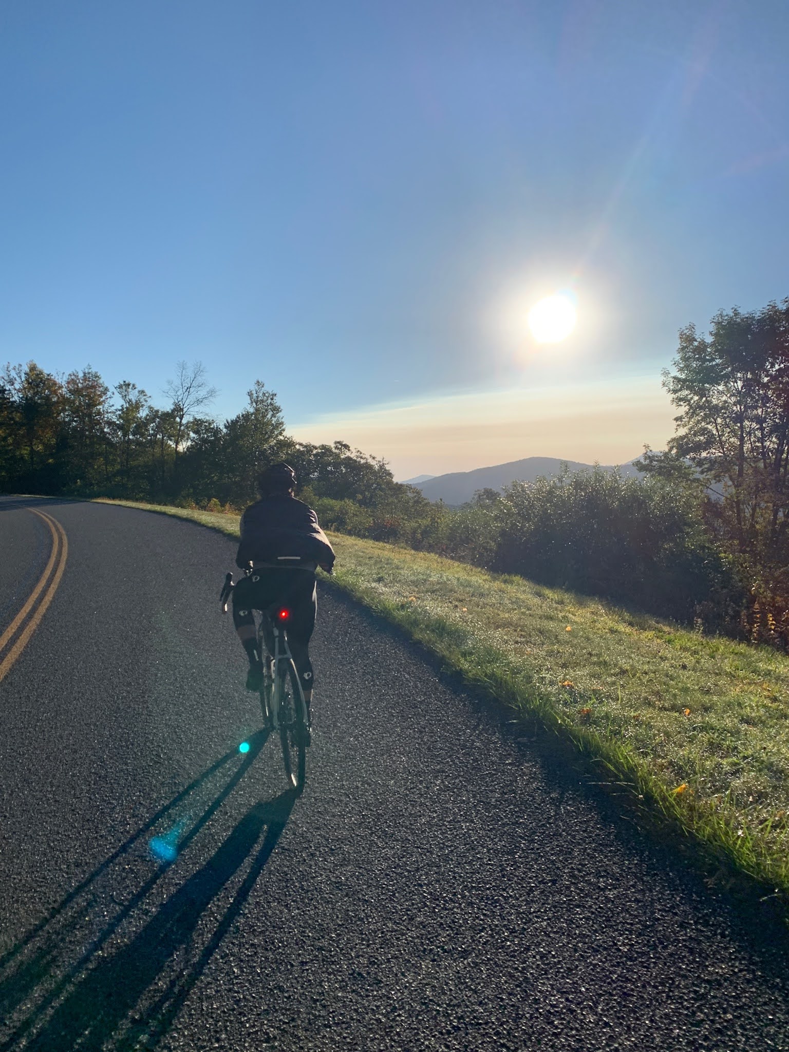
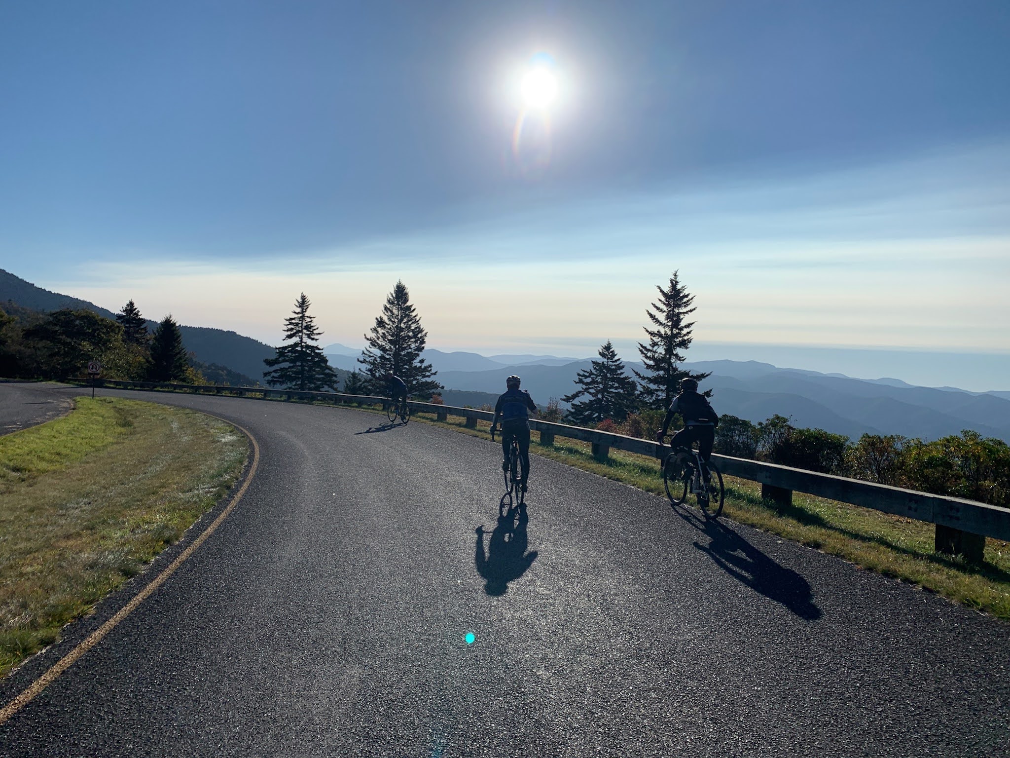
We thanked Jelly for the transportation and said our goodbyes. It was right at 7:00am and we began our ascent towards the clouds. We spent a little while figuring out the right pace(some of us took longer than others) to use for 4 days and just generally settling in for the long haul. The climbing was easy and the elevation gain seemed to tick away pretty quickly. For you cycling folks, the average grade of the parkway is 5-6%, which is rather manageable. Of course, there are sections that pitch up and other sections that are just false flats. I was rather happy with my gearing choice.
A QUICK BLURB ON GEAR SELECTION
I rode my OPEN Cycles U.P. gravel bike with 32c Teravail Rampart tires. I replaced the salsa woodchipper bars with Ritchey 44cm road bars without any flare (thanks Big A!) and wrapped them with some salsa bar tape. I took some old foam grips and cut them longitudinally and wrapped them around the top of the handle bar and then wrapped tightly with electrical tape, for added cushion/comfort for my hands. I changed my crank from XT to SRAM Force and replaced the 42T ring with a 38T. The cassette was a 10-42 SRAM GX. Saddle was an Ergon SMC4 Pro. Seat post was whisky parts carbon post. Pedals were SPD road style pedals. A good friend, Will Boulware, let me borrow his revelate designs half frame bag and I used my Rockgeist XL tank bag.
The initial climb from the start was about 10 miles long and gained about 3k feet, taking us to around 5,500ft above sea level. We watched the sunrise and viewed the sea of clouds in the valley below us along the way. I think there were something like 40 overlooks in the first 50 miles; the views are endless.


Comments
Post a Comment